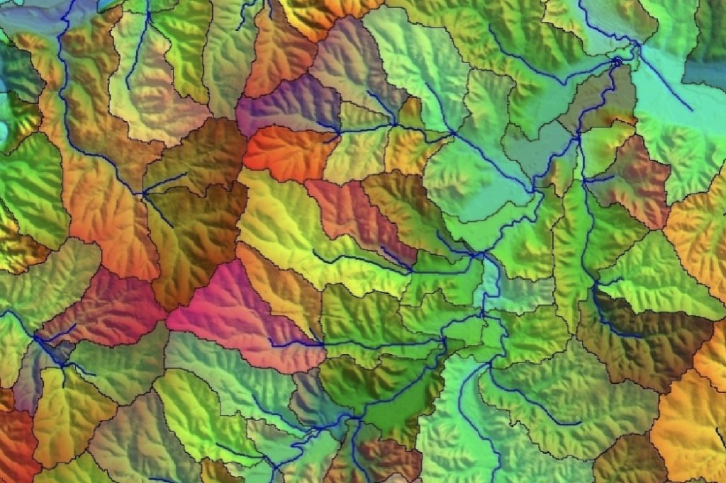
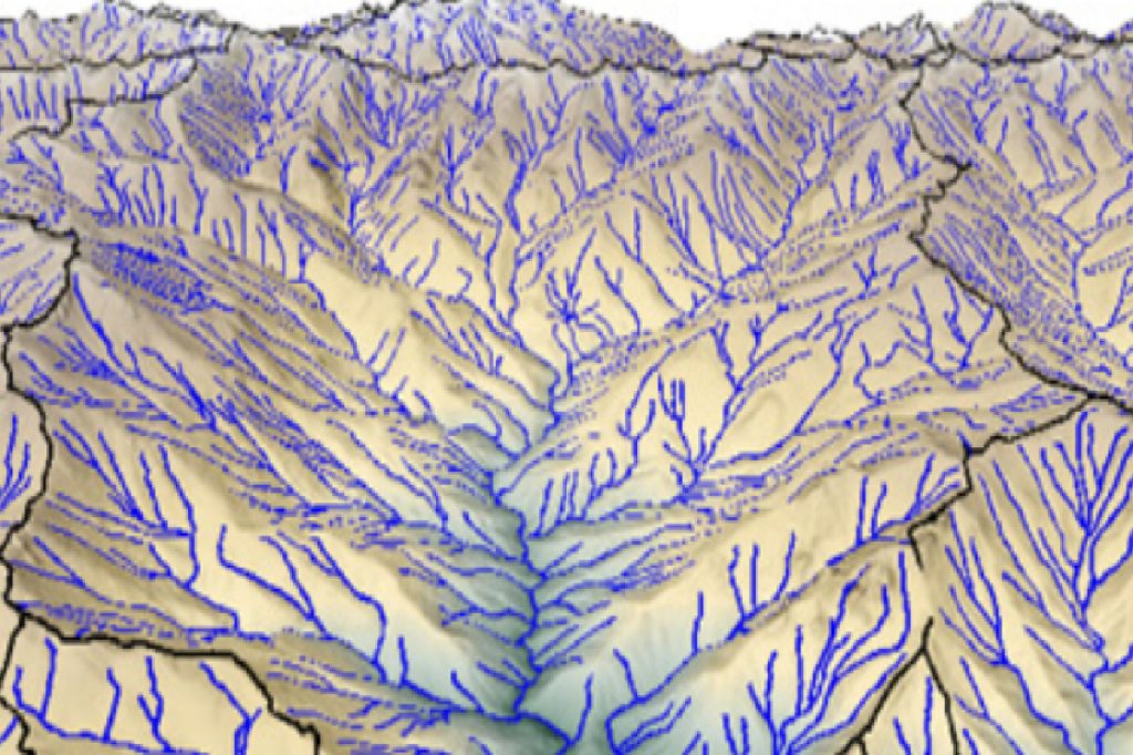
Watershed analysis using airborne lidar provides valuable information for watershed management, including identifying areas that are vulnerable to erosion and flooding, planning land use and vegetation management strategies, and designing erosion and flood control measures.