LiDAR is quickly establishing itself as a critical technology for civil engineering firms around the world.
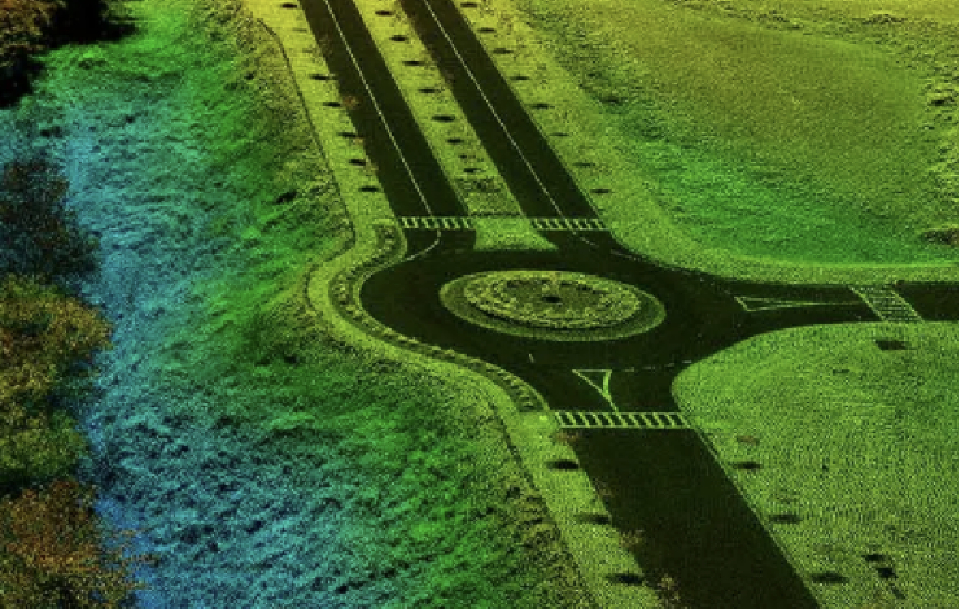
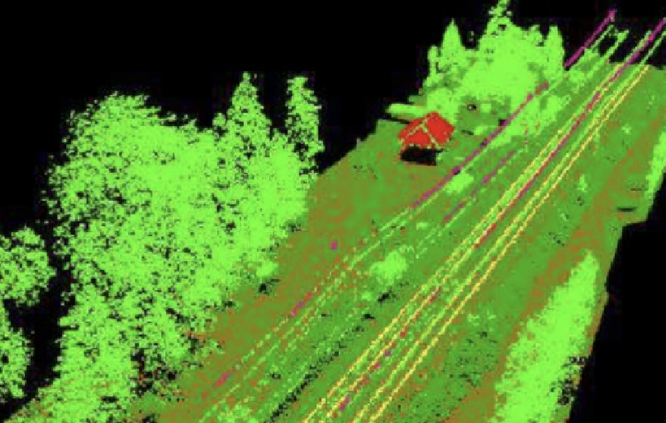
This technology provides valuable information for the design of new urban and rural roadways and railways. LiDAR data can be used for feasibility studies, design, and maintenance of roads and railways. It saves time and money by identifying clearance hazards without the need for a site visit, allowing for more informed decisions about when and where to deploy clearing crews. Kîsik’s utility vegetation management solutions include lidar-based clearance detection analytics, volumetric analysis, hazard tree detection, change detection, and species identification.
Kîsik’s GIS services consist of large-scale mapping solutions, including low-level/high-accuracy LiDAR and low-altitude photogrammetric mapping. From this data, Kîsik provides dense elevation point clouds, TINs, digital elevation models (DEMs), and maps depicting closely spaced contours and detailed existing conditions. In addition, our high-resolution orthophotography is considered by many engineers to be an indispensable design tool.
Typical Use Cases
Planning
Projects in civil engineering are inevitably big and complicated. To plan and develop a project, you’ll need survey results, long-term plans, maps, and data. But throughout the planning and risk analysis, engineers must also take into account construction expenses, governmental requirements, and potential environmental dangers – and LiDAR is playing a significant role in this.
Monitoring
Many civil engineering structures have to be permanently monitored to provide early warning of structural failure or the need for remediation work. LiDAR data can pick out small details, such as the condition of structures, so if a building or piece of infrastructure is in danger of falling into neglect, LiDAR can help identify it.
Sustainability
LiDAR-informed construction projects lend themselves to new sustainable techniques such as prefabrication. Smart cities can be created to minimize environmental impact and maximize resources.
Safety
The use of LiDAR for “prevention through design” improves safety. Engineers, for example, can prioritize the well-being of on-site personnel during the design phase. This can be as simple as installing anchor points in locations where workers are at high risk of falling.