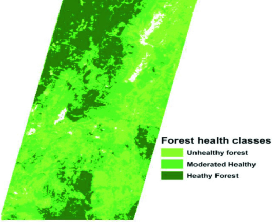
AisaFENIX is an advanced hyperspectral imaging tool for efficient implementation of full spectrum VNIR + SWIR applications both on the ground and in the air. The data that Kîsik produces has a very high spatial and spectral resolution, making it suitable for a variety of uses, including geological and geothermal exploration, fire and flood risk analyses, vegetation health assessments, forest inventory, and environmental monitoring.
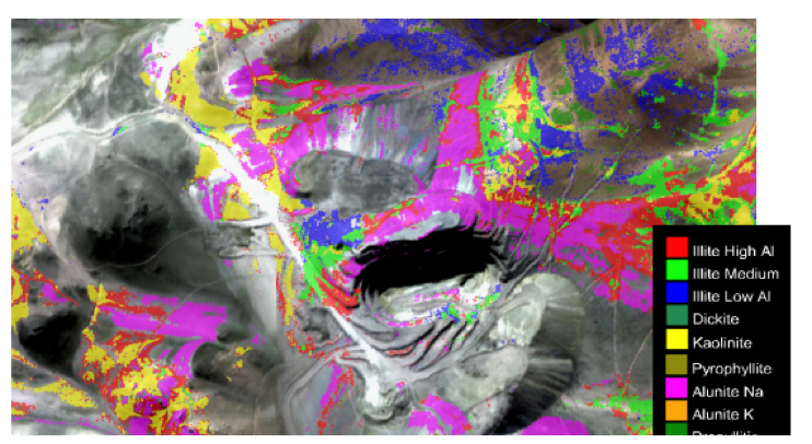
Airborne hyperspectral imaging is a powerful tool for geological mineral mapping. By capturing images across a wide range of electromagnetic wavelengths, hyperspectral cameras can identify unique spectral signatures associated with specific minerals. This data is then analyzed using advanced image processing techniques to create detailed maps of mineral deposits and their surrounding geological features. This technology is particularly useful for identifying mineral deposits in remote or inaccessible areas and can greatly aid in mineral exploration and resource management. At Kîsik, we offer expert airborne hyperspectral mapping services to help clients better understand their geological environments and make informed decisions about their mineral resources.