Hyperspectral imaging can be used for a variety of different applications in agriculture including crop mapping, yield estimation, irrigation scheduling, soil characterization, and pest detection. Farmers can use hyperspectral images to map their crops so that they know exactly where each type of crop is growing. This information can then be used to estimate yields using crop models that take into account factors like plant density and leaf area index.
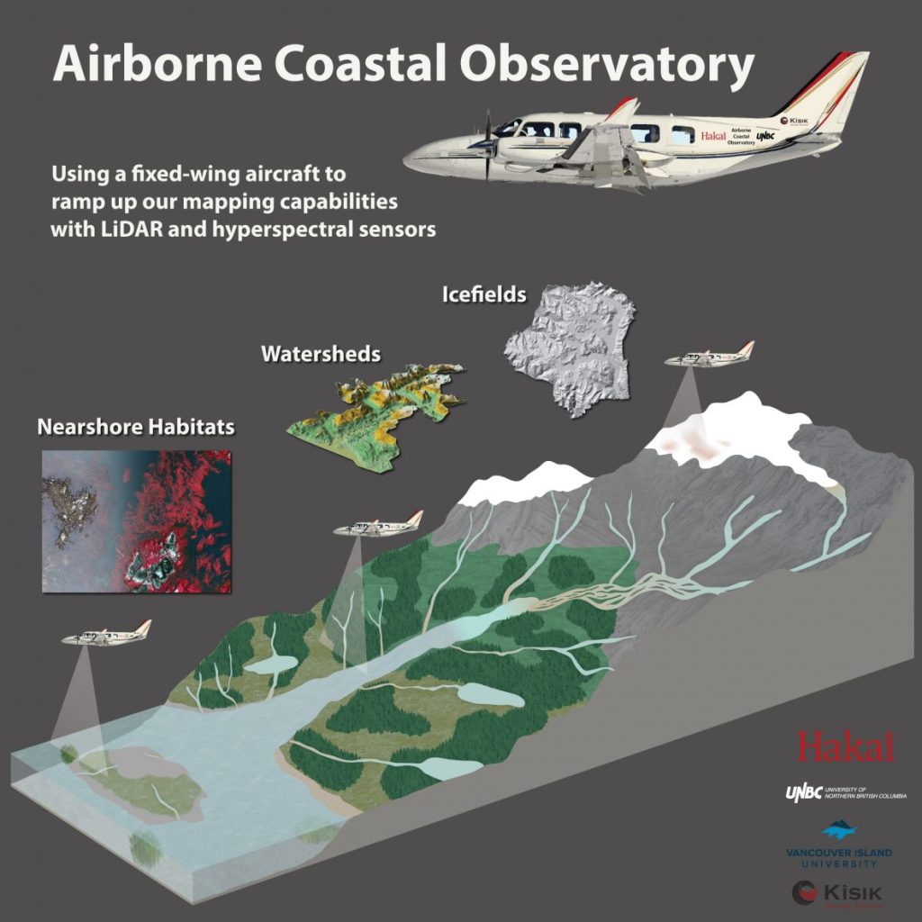
The Airborne Coastal Observatory (ACO) features a variety of sophisticated technologies, including LiDAR and Hyperspectral sensors, in order to examine and monitor indicators of climate change and inform a wide variety of scientific questions from BC’s icefields to oceans.